By Brenna Wiegand
What a great way for an older, less technologically savvy bunch to grasp GPS and the opportunities it affords than The Oregon Garden.
A June 13 event at the Garden was the initial outreach for support of a new, ambitious project to utilize a global positioning system (GPS) and geographical information system (GIS) to map coordinates and horticultural information for its plant material.
Sumptuous food and drink by the resort chef including GPS martinis and 45th Parallel Manhattans kicked off the party while GPS experts Chuck and Carol Vanlue supplied the Garden and Oregon Garden Foundation members with a basic introduction to the subject. Most were senior citizens, some keenly interested; others just glad for a night out.
Chuck – some 5,300 caches under his belt – said geocaching got its start in 2001 after former President Bill Clinton signed a law to stop scrambling signals heretofore accessible only by military aviation.
“The day after it was signed into law, a fellow from Clackamas said, ‘Hey, this is a really good idea.’ He went out into the woods with a 5-gallon paint can into which he put a can of beans.
“He went home and e-mailed its coordinates to his friends. So, geeky people that they were, they went and found it, having so much fun that they told their friends,” Vanlue said. “All of a sudden you have a device that is worth something – navigation in your car; on smart phones; for hunting…”
Today 5 million people worldwide geocache, with 2.3 million caches hidden around the globe.
“It’s a sport; it’s a game – it’s something people do,” Vanlue said. “I enjoy doing it when I’m out of town on business and personally have found them in Argentina, India, Greece and Turkey. I venture to guess there are at least 10 within a mile of each of your houses – no matter where you live.”
The best thing about geocaching as a pastime isn’t so much the vessel bearing nothing but a logbook, but the places experienced getting there.
“I’ve found walks, hikes, historical places and parks I never knew existed because somebody placed a geocache there.”
The routes are rated 1-5 by difficulty; a No. 1 being handicap accessible.
“A No. 5 you’re going to need a canoe; you might need scuba gear; it could involve climbing – very serious stuff.”
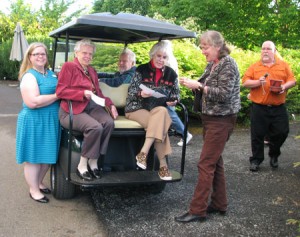
By now the group was eager to step into the Garden for a GPS activity of its own. Handheld, preprogrammed devices in hand, they split into teams – enjoying each other as much as the hunt. When the first cache was discovered beneath a mock orange, there was cheers and applause all around.
Using ArcGIS software, provided through a grant by ESRI, the Garden will gather information that will be used to to create a layered, interactive map of the Garden that will be of great help to staff and in its requests from plant repositories or societies. Irrigation systems and electrical layouts will help with event planning.
Plans involve assigning QR codes to each plant that visitors scan to learn what it is, its attributes and, through partnering with local nurseries, where they can get one.
The Garden plans to create a mobile app and a touch screen kiosk in the Visitor Center providing an interactive map, personal tours and plant information.
“Only a handful of gardens throughout the world have done this type of extensive GPS mapping, so we will be one of a select group in the nation to really adopt the technology,” explained Beth Maurer, GPS project coordinator. “And having a GPS system will allow for fun learning activities for kids and adults.”
For information, to donate or help with mapping, contact Maurer at [email protected] or 503-874-2533.
